
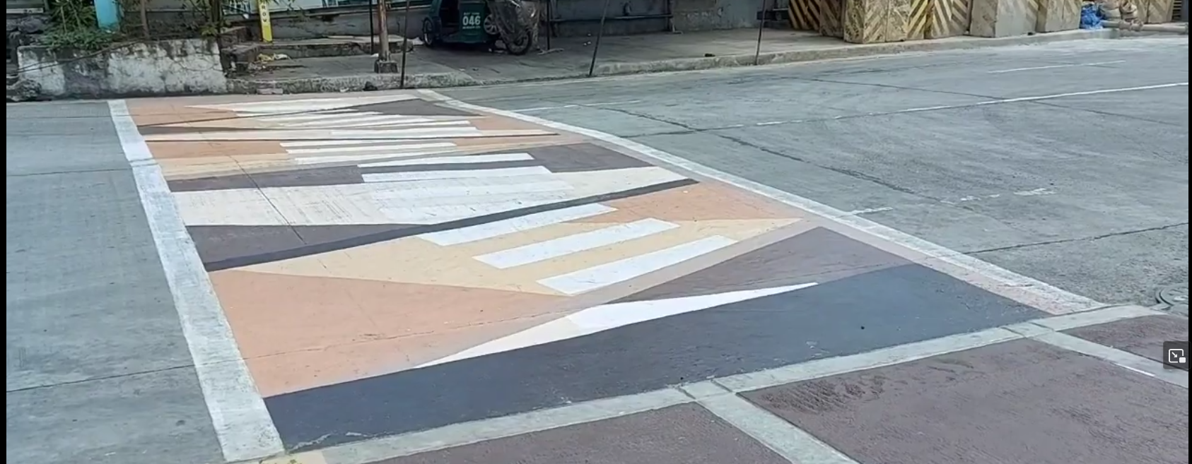
A nearby city call these crossings as “Gora¹ Lanes”, an attempt to make walking fun, attractive, and accessible to more people.
From the screenshot² below, it’s something like an arty zebra (or “continental”) crossing, and I saw minimal use of crossing:markings=artwork in #OpenStreetMap, and taggable with crossing:markings=yes.
I wonder how you folks might tag it.
¹ - Gora is an acronym from “Green Open Reclaimed Access”
² - Source: screenshot, https://yewtu.be/lKMFjLcTVkQ?t=59
@zephr_c
Well, unfortunately, what we see on the ground (and try to map in #OpenStreetMap ) is not necessarily always what we (or the locals) wanted, or hope to ever see.
Hopefully, it’s a work in progress, and they get around to fixing more essential things. 🤞