
- cross-posted to:
- opensource@lemmy.ml
- cross-posted to:
- opensource@lemmy.ml
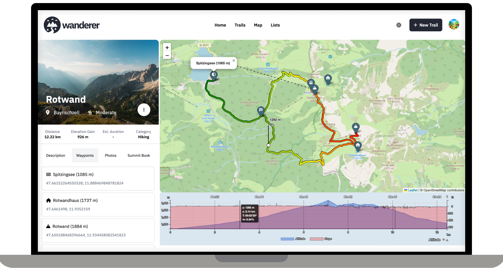
Over the last two months, I developed wanderer. It is a self-hosted alternative to sites like alltrails.com or in other words a self-hosted trail database. It started out more as a small hobby project to teach myself some new technologies but in the end, I decided to develop it into a fully-fledged application.
Core Features:
- Manage your trails
- Extensive map integration and visualization
- Share trails with other people and explore theirs
- Advanced filter and search functionality
- Create custom lists to organize your trails further
- Chique design with a dark and light theme
- Fully mobile compatible
wanderer is completely open-source. You can find the GitHub repo here: https://github.com/Flomp/wanderer
wanderer is still under active development so if you encounter any bugs/errors or have suggestions please let me know here or open an issue on GitHub.
Welcome to Lemmy! I recently posted about Wanderer also in another self-hosting community: https://slrpnk.net/post/7887187
As someone interested in self-hosting this, I have two questions:
How far is it suitable for say a local hiking association or a small municipal government to use this as a public trail database to promote regional eco-tourism efforts? Where I live the local government has something like that, but it is badly maintained. For that to work it would need to have the ability to easily find trails on an overview map and to allow posting notices about trail closures etc. (ideally even crowd sourced?) Maybe also some way to mark trails as official, if they are designated and sign-posted.
Unrelated: have you thought about allowing the live-tracking via apps like Phonetrack or OSMand? I think that would make it both more convenient for uploading tracks (at least where there is sufficient cell-coverage) and might add an interesting social aspect to it if you can share your live-location with other users.
P.S.: Would be great if you could add it to https://translate.codeberg.org/ for adding additional languages easily.
Thanks for promoting wanderer! Finding trails on the map should be no problem, you can currently mark trails as public so that not logged-in users can see the trail. I have thought of steering wanderer towards a more socially interactive platform. I think a good first step would be to allow comments and implement a rating system.
Thanks for the crowdsourced translation website. I was looking for something like this. I will set it up and add it to the contributing section of the documentation.